PlantPredict
Bug Fixes
Effective Irradiance Bug
We’ve corrected an effective irradiance bug that was introduced in version 11.33.0 which was released August 29th. It is recommended to re-run any predictions that have been run between August 29th and September 5th. A banner instructing users to re-run will display on any such predictions as well.Terrain Pro
New feature and improvements
New GIS server
A new dedicated GIS server has been implemented to store layers generated from Terrain Pro’s calculation outputs and to retrieve them without overloading the browser’s memory capacity. This new approach enables Terrain Pro to visualize any heat map layer, pile layer, or the newly available contour layer without limitations on the size of the array extension.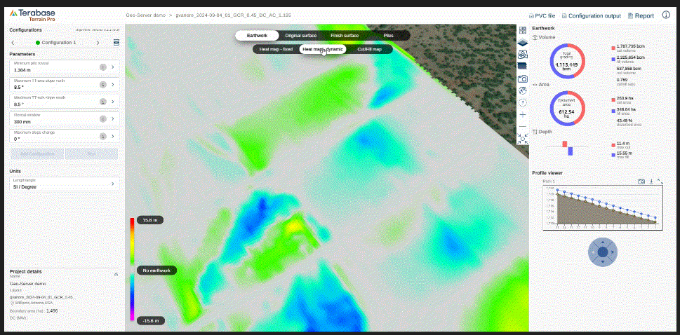
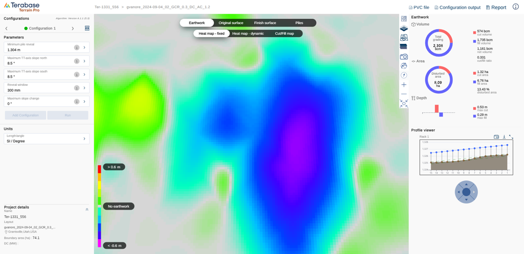
New heat map style
The style of heat maps in Terrain Pro is transitioning from a triangular representation of the areas of cut and fill between piles to a more detailed gradient representation. This new approach provides a more accurate depiction of cut and fill areas with higher pixel resolution.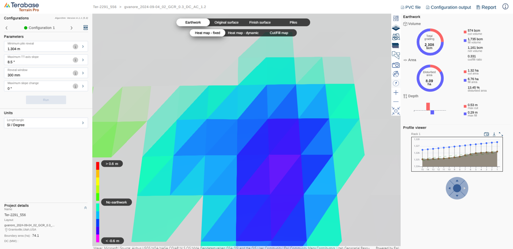
- Earthwork heat map with fixed legend
- Earthwork heat map with dynamic legend
- Cut and fill map
- Original surface heat map
- Finished surface heat map
Contour layers for existing and finished surfaces
Contour layers for both existing and finished surfaces are now available in Terrain Pro. These layers represent the elevation lines of the terrain at specific intervals, showing the shape and slope of the landscape. Contour layers are typically used to visualize and analyze terrain features, such as slopes, ridges, and valleys, which are essential for planning and optimizing solar array layouts.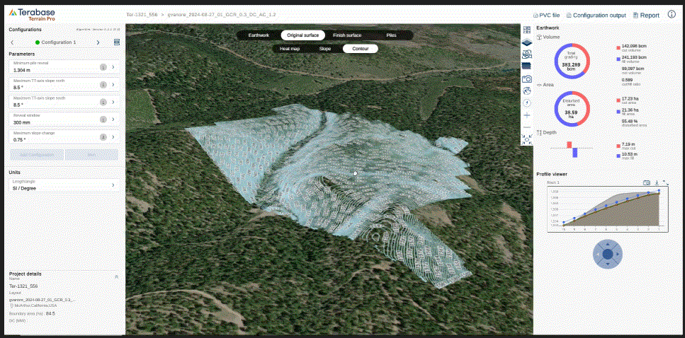
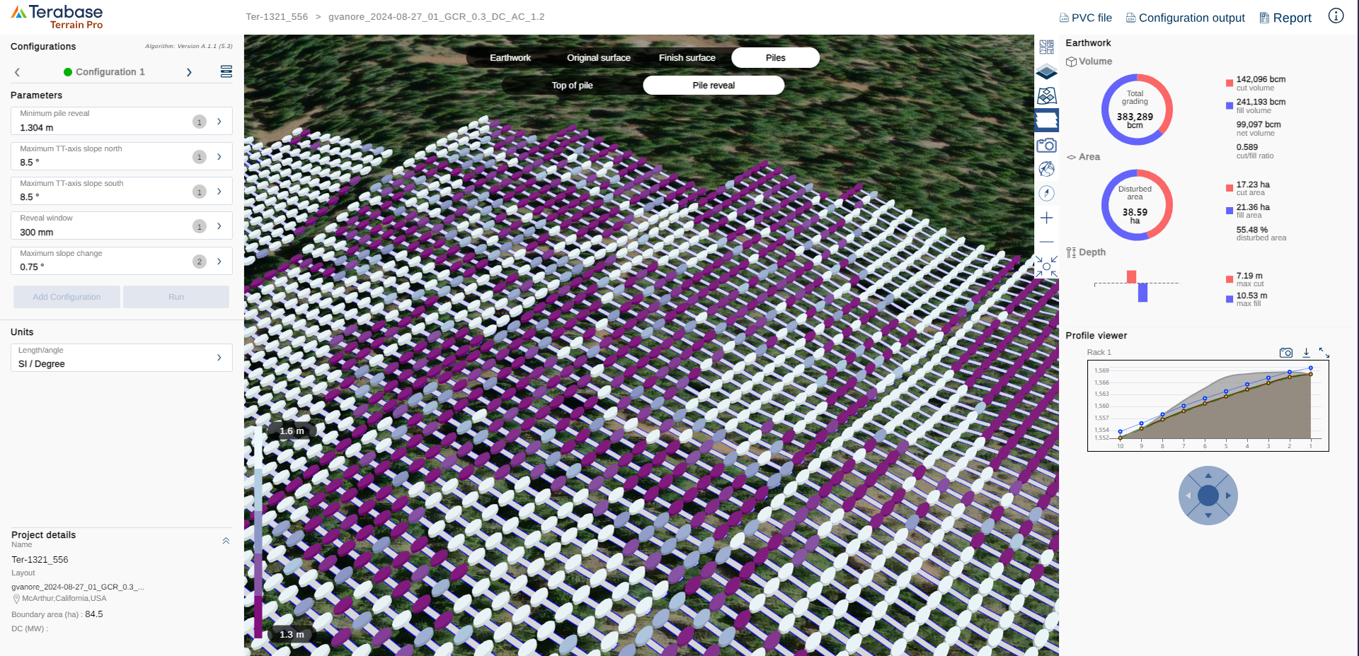
Pile layers
The top of the pile and pile reveal data are now also stored on the new GIS server, providing a quick and reliable way to access this information. When either of these layers is activated, the rack projection layer is automatically enabled to help better identify the pile positions within each rack. This enhancement improves visualization and understanding of the spatial relationship between piles and racks, making it easier to assess alignment and placement during design and planning.