- Cloning a Map Builder Prediction does not clone the Boundary, constraints or DC flood
- .PPP files don’t import properly
- Better handle accounts that are downgraded from Professional to Premium
- Fix missing static files for NonProd and UAT
- Batch iterations do not work via the UI (DC/AC ratio in combination with GCR iteration)
- Time Series Downloads do not include details past 8760
- When MapBuilder page is refreshed, many values return as ‘undefined’
- Uploaded .TIF Data was not used in the 3D Site View as expected
- Improve Time Series Upload Error Messages
- Refactor Time Series to work faster with Multi-Year Predictions
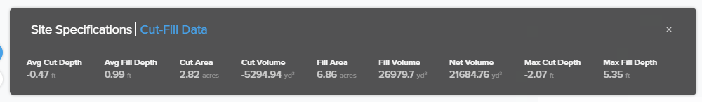
- Addition of new interface supping Cut/Fill Analysis outputs and calculations
- Implement new Report Generation plan that has better performance
- MAX SITE CAPACITY to update without need for invisible DC features
- Reduce filtering of elevation points so they are closer together to better see the change in elevation when the survey layer is turned on
- Introduction of several Premium user features:
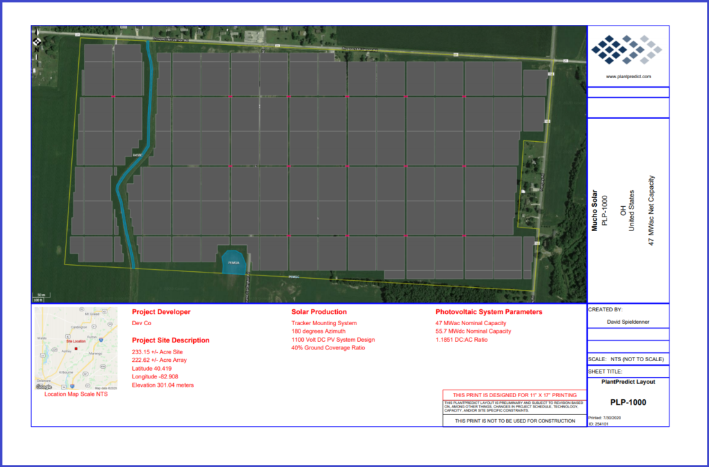
– Ability to download a PLP-1000 Layout diagram (PDF) from within the MapBuilder tool
– Ability to do Cut/Fill Analysis using DEM, TIF, or Google elevation data
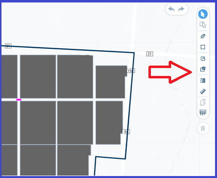
– Single or multiple component selections
– Cloning of selected DC tables, arrays, PCS
– Delete selected DC components from the layout
– Drag/Move/Snap DC components to desired locations
– UNDO/REDO capabilities - Enhanced layer selection available to Premium users:
– Parcels, Survey (Elevations), Earthwork (Cut/Fill), Slope Constraints, Slope Banding, Post Analysis