August 18, 2022 Roadways are now available in MapBuilder We have added a Roadways (Census) layer to our MapBuilder Map Overlays menu.  Now users can turn on this layer and have the software automatically draw constraints around the roadway easement with the click of a button.
Release 10 07 0 Image1
We also made the “Handles” a little easier to see when you want to modify a site boundary.
Release 10 07 0 Image2
Some other improvements were made to the MapBuilder interface:
  • The snapping feature has been added to the site boundary, so drawing a site boundary is easier now
    • When Calculating DC Capacity on a site with multiple site boundaries, the system will consider each site boundary as an island and maximize the DC accordingly
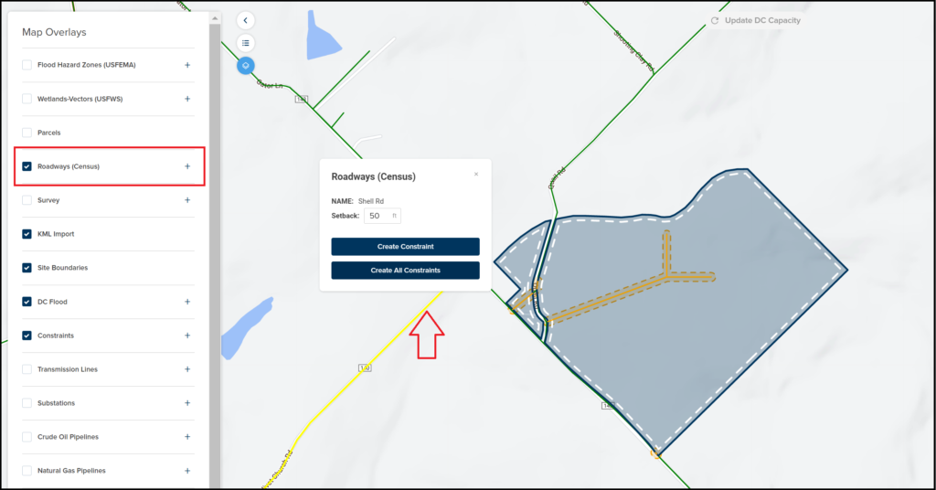
    • We also refactored our wetland layer to comply with the changes made by the US Fish and Wildlife API
On the Subscription Page, we added a “Promotion Code” functionality, which can be used to give out Free Trials of PlantPredict Premium.  We plan to try this out at the PVPMC conference coming up next week when we will be giving out Promo Code Cards to Performance Engineers who want to give PlantPredict Premium a try.  Hope to see you there! BUG FIXES
  • Loss factor tree – adjusted the chart so that small values (i.e. 1%) look different than 0%
  • Updated Error Codes for when Predictions Fail to make it easier to troubleshoot the reason why a prediction failed.